BlueConduit Starter provides free resources to help water systems of any size compile a compliant Service Line Inventory and plan for lead line replacements, budgets, and community engagement.
These free tools were developed as part of grants from Google.org and The Rockefeller Foundation.
Starter Tool #1
Lead Service Line count & replacement cost estimate report
This custom report details system-level lead estimates and expected replacement costs for the unique water system. This helps water systems understand their likely project scope and plan for funding requests such as to a State Revolving Fund (SRF). The system-level predictions are generated by applying BlueConduit’s state-of-the art predictive modeling approach to publicly available data, building on published academic research by BlueConduit.
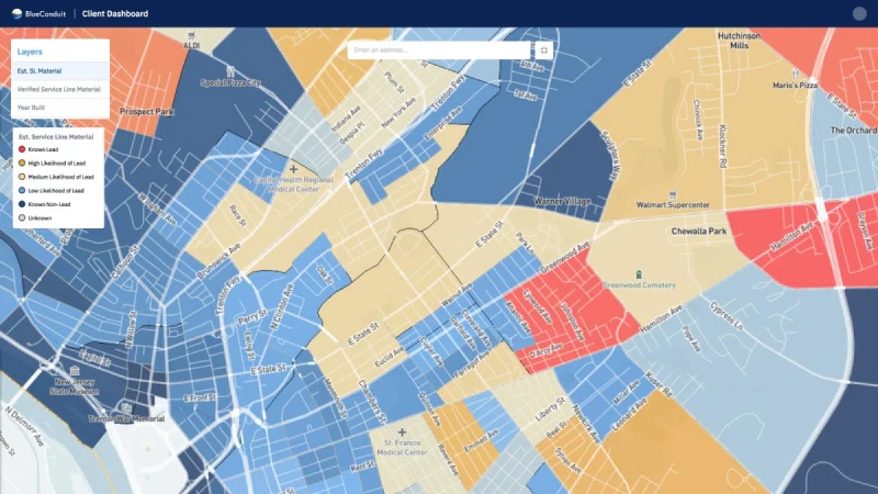
Biased data in your Service Line Inventory can lead to difficulty understanding the actual scope of lead in your water system, accessing adequate funding for replacements, and creating an efficient, effective, and equitable replacement plan. BlueConduit’s free Data Bias Report provides information about common biases in inventory data, as well as an assessment of bias in your Inventory.
Explore downloadable guides and whitepapers on a variety of LSLI-related topics – from how to begin compiling and inventory to managing data bias and more.
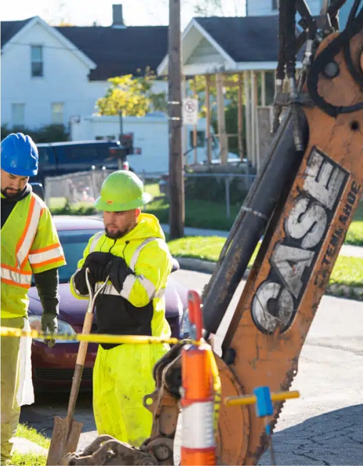
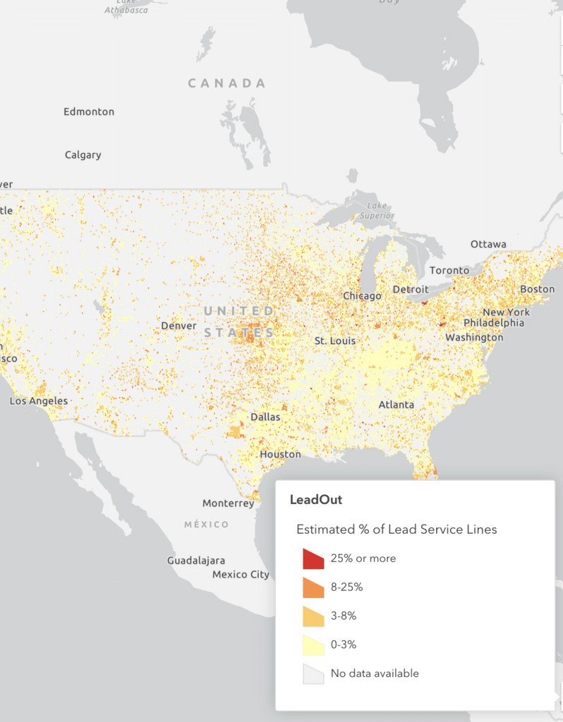
BlueConduit believes that people who live in the U.S. have a right to know where lead service lines may exist and have access to resources to help protect themselves.
Since our founding, BlueConduit has collected publicly available data about lead service lines. The LeadOut Map is the result of our commitment, alongside our partners, to make this data available for free and in one place. LeadOut Map is an educational tool that that uses predictive modeling and AI to show where communities might be at risk of exposure to lead in their drinking water.
A Partnership with BlueConduit, the Rockefeller Foundation, and Google.org
LeadOut Map is the product of a collaboration between academic, foundation, nonprofit, and technology partners committed to informing the national conversation about lead in our drinking water.
<span data-metadata=""><span data-buffer="">How it was built
LeadOut Map’s data collection and technology design was funded by The Rockefeller Foundation and Google.org. A team of Google employees—researchers, designers, product managers, and software engineers—worked with BlueConduit on a full-time, pro bono basis to help build the tool through the Google.org Fellowship program. LeadOut Map’s machine learning technology is powered by BlueConduit.
LeadOut Map is made possible by nonprofit partners who lend their expertise and resources to help ensure the public has the education and tools they need to help protect themselves against lead in drinking water. These partners are the Environmental Defense Fund (EDF), Environmental Policy Innovation Center (EPIC), the Natural Resources Defense Council (NRDC), and WE ACT for Environmental Justice.
Ready to take the next step in your water management journey? We’re here to help!
Set up a consultation with BlueConduit to learn how we can turn these high-level insights into actionable steps for your utility.