
Originally published on Bloomberg Law by Bobby Magill.
- Detroit saved $380 million using AI mapping tool for lead pipes
- Cities may report many pipes made of ‘unknown’ material
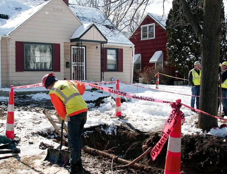
Detroit is among a few cities using a new artificial intelligence-driven tool to find lead drinking water pipes, saving the city millions of dollars and helping it in its scramble to meet the EPA’s Oct. 16 inventory deadline.
BlueConduit, which was founded by University of Michigan researchers working to solve the Flint water crisis, is hoping the LeadOut Map will make drinking water systems better equipped to replace lead service lines more efficiently and at lower cost.
The technology, which uses data from the Environmental Protection Agency and other sources to identify properties likely to be connected to the water main with lead pipes, has saved Detroit $380 million because it prevented the city from having to dig up 300,000 yards, city spokesman Bryan Peckinpaugh said.
“If not for BlueConduit, we would technically have to dig up every curb and stop box and determine if there’s lead or not,” he said.
Lead drinking water pipes, which were installed in many homes throughout most of the 20th Century until they were banned in 1986, became a public health concern after the 2014 water crisis in Flint, Mich. Incidents of lead poisoning became widespread there after the city changed its water source.
The Biden administration has prioritized replacing those pipes over the next 13 years under the Environmental Protection Agency’s new Lead and Copper Rule Improvements (LCRI) regulation, which is set to be finalized before mid-October.
Drinking water systems are expected to spend about $125 billion to replace up to 10 million lead drinking water pipes through 2037, according to the consultancy Arcadis.
Under the LCRI, the EPA proposes to require all drinking water systems to replace 10% of their lead pipes annually over 10 years starting in 2027. Those cities are also rushing to submit initial inventories of their lead service lines ahead of an Oct. 16 deadline required under the EPA’s Trump-era Lead and Copper Rule.
Mapping ‘Unknown’ Pipes
A lot of water systems are expected to report that many their water pipes are of “unknown” composition in their initial inventories due in October. As cities go about investigating what those pipes are made of, BlueConduit hopes its AI-driven technology will help them fill in the gaps in their data and find the lead pipes more easily.
“Every water system has the ability to just submit to their state agency in October any number of ‘unknowns,’” said Eric Schwartz, co-founder of BlueConduit. “What we’re trying to do is anticipate that.”
The LeadOut Map uses EPA data, local property records, and other data about a city’s housing stock to predict whether a lead service line connects a property to the water main and help fill cities’ data gaps. After the October inventory deadline, the map will be updated regularly to account for new service line data.
“The biggest long term vision is in order to get all the lead out, we need to track the progress that water systems are going to make throughout the next 10 to 13 years,” Schwartz said.
The city of Summerville, S.C., used BlueConduit’s technology to determine with 95% confidence that the city’s water system has no lead pipes even as the city still has to verify the composition of 10,000 remaining pipes, said Megan Schweitz, the lead and copper coordinator for Summerville Commissioners of Public Works.
“Summerville CPW had verified 65% of our service lines before working with BlueConduit using historical data,” she said.
Some cities are using predictive modeling technology but are unable to complete their lead pipe inventories with it because state regulators won’t allow it.
“The state of Texas is not accepting predictive modeling to fill out our inventory,” said Kirsten Eller, potable water quality supervisor for the San Antonio Water System, or SAWS. “We’re using predictive modeling as a means for planning.”
SAWS, which does not use BlueConduit’s software, uses a consulting firm’s technology to help the utility predict where to find the highest concentrations of lead lines. Crews will check for lead pipes as they install new electronic smart water meters at each property.
The city’s inventory will still include a lot of pipes of “unknown” material, Eller said.
“We’re one of the largest utilities in the country,” she said. “Having an ‘unknown’ in the inventory just means we’re in the process of finding more information.”
Showing Data Gaps
The Natural Resources Defense Council, an environmental group advocating for lead pipe removal, released its own map showing where concentrations of lead service lines are likely to be found.
NRDC’s map shows cities that have the highest number of lead pipes, including Chicago with about 387,000, Cleveland with 235,000, and New York City with about 112,000.
The difference between the two maps is that NRDC’s map is based exclusively on EPA data, and BlueConduit’s map uses more data sources to make predictions about lead pipe locations where there are a lot of pipes of unknown composition, said Eric Olson, NRDC’s senior strategic director for health.
BlueConduit’s map is “interesting because it shows where an AI approach would predict where we might see more lead pipes,” Olson said. “There are a huge number of pipes that are unknown. That’s a fundamental problem because the water utilities should have been developing estimates and doing surveys of where the lead pipes were years ago.”