
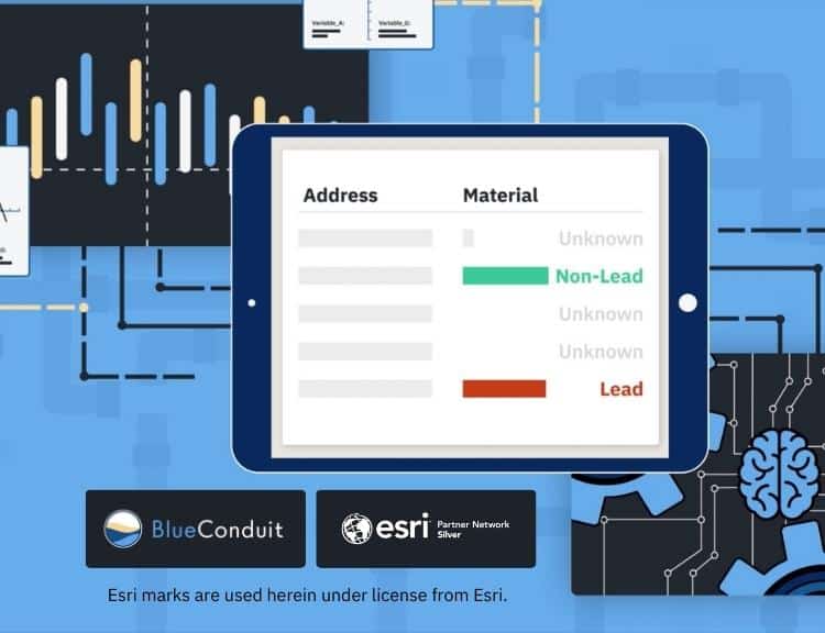
Data science and location intelligence collaborate for Lead and Copper Rule Revision compliance
(ANN ARBOR, Michigan) September 27, 2023 — Water analytics pioneer BlueConduit proudly announces its integration with Esri, the global leader in location intelligence. This technical integration and go-to-market partnership will bring BlueConduit’s machine learning to utilities using Esri ArcGIS technology. Water utility customers will have a single place to view and update their service line inventory using familiar, flexible, and powerful ArcGIS Online and its lead service line inventory solution.
“The potential for lead exposure via drinking water service lines remains a problem in communities across the US and Canada,” said Lorne Groe, CEO of BlueConduit. “Utilities have widely adopted ArcGIS technology for their daily operations and long-term infrastructure planning. Integrating with Esri in this way helps us meet water utilities where they are and meets our goal of helping utilities get the most lead out as efficiently as possible in terms of cost and schedule.”
According to the EPA, over 9 million homes nationwide get their drinking water through lead pipes. That’s more than 20 million people with the potential for lead exposure on a daily basis. In December 2021, the EPA released its Lead and Copper Rule Revision, which requires all U.S. water systems to develop lead service line inventories by October 2024. Under this deadline, the nation’s utilities must inventory and remove these lead service lines. Yet, finding the lead pipes has been a logistical challenge. This information gap drives the need for predictive modeling and location intelligence.
The BlueConduit team originated the approach of using data science to predict service line materials in 2016. Water utilities use BlueConduit’s address-by-address predictions for their lead service line inventory and replacement programs. Their predictions have enabled utilities to locate lead in greater than 80% of attempted replacements, accelerating the removal of lead and lowering the cost per successful replacement.
About BlueConduit
BlueConduit, the pioneer in using data science to find lead pipes, has applied machine learning models across over 200 communities and water systems in over 20 US states and in Canada. The EPA included BlueConduit’s work and predictive modeling in its Service Line Inventory Guidance. BlueConduit is a Silver Partner in the Esri Partner Network (EPN), has earned the EPN System Ready designation, and has solutions available on the ArcGIS Marketplace (more about BlueConduit’s Esri Partner participation). Access to the BlueConduit platform is supported for disadvantaged communities in part through grants from Google.org and The Rockefeller Foundation. Learn more at BlueConduit.com.